The latest destination on my Virtual Hike was Ashland, Kansas. This location is very familiar to me as it is where I graduated from High School. I could share many pictures and memories of the town, but these are subjects of other posts. Instead, I will share some pictures from Google Maps of what I would see along the way if I had actually been there hiking.
I am also way behind in getting this written. It did not take me this long to get to Ashland from the last stop.
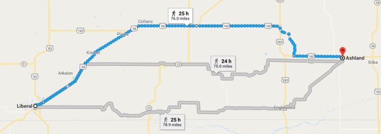 Here you can see the route from the Liberal, Kansas which was the last stop on the Virtual Hike. You can see that I had choices of routes, but I took the northern route. I did this for two reasons. One, I was very familiar with the route along 160 as I had driven it many times and second I wanted to take my Virtual Hike through the Big Basin. The map does not show the exact place where I deviated from 283, but it is an approximation.
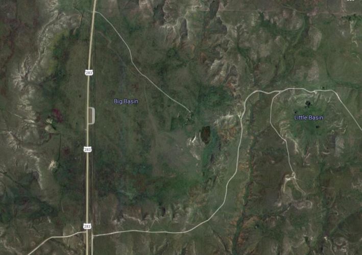 The Big Basin is a sinkhole that is about a mile in diameter. It has historical significance as a camping place for the Cheyenne and also as a stopping point on the trail drives from Texas to Kansas railheads.
A little to the east is a smaller sinkhole called the Little Basin. Within the Little Basin is a natural well called Jacob’s Well.
 The highway runs right through the Big Basin and so I have been through it hundreds of times in my life. Whenever we went to Dodge City, Meade or to many other destinations on school trips we would pass through the Big Basin. Sometimes we would see antelope or buffalo in the Big Basin as it is part of a nature preserve.
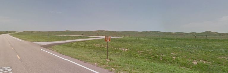
 After leaving the Big Basin the next thing to look for were the iconic Red Hills that flank the highway as it heads toward Ashland.
I have some good memories of this area, especially rappelling off the bridge that is just ahead. I thought about pulling in a few pictures I have of the Red Hills, but instead you can view them here: Red Hills in Snow and Red Dirt Country
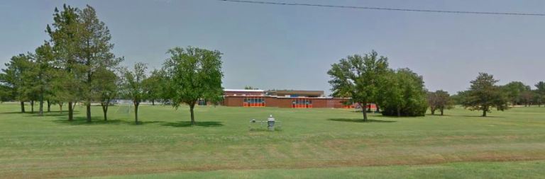 One of the first views after entering the city limits is the High School. There are many memories running through my head as I write this.
 Of course I also had to hike along familiar streets to the old house we lived in. It looks a bit different as it was a white house when we lived there. The trees are much bigger, and there are a lot of little changes. However it is still a familiar site.
While preparing this post I also used Google Street View to visit many places in town to see how things have changed. It has been a very long time since I have been back to Ashland.
Now to figure out the next destination for the Virtual Hike. I have a few stops in mind. Wherever I pick I am well on my way there. However, not as far as I should be as a stubbed toe, travel and unhealthy air have kept me from walking as much as I should. I am hoping that the air will start clearing this week so I can again go for evening walks.
Have you been to Ashland, Kansas?
Steven
