The next destination on my Virtual Hike was Fort Ticonderoga.
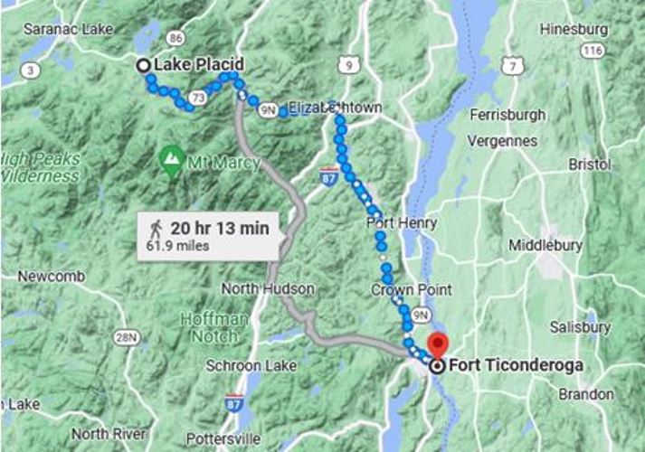 The previous destination on my virtual hike was Lake Placid, New York.
 The virtual hike from Lake Placid to Fort Ticonderoga first went through the mountains of northern New York and then down to Lake Champlain.
 The route through the mountains was very scenic. Some of the Google Maps images were from fall and showed colorful trees along the way.
 Fort Ticonderoga was a large star fort that was used during the French and Indian War and also the Revolutionary War. The fort was in a strategic location on Lake Champlain. One of the things that the fort is remembered for was that after it was captured from the British the cannons from the fort were taken to Boston.
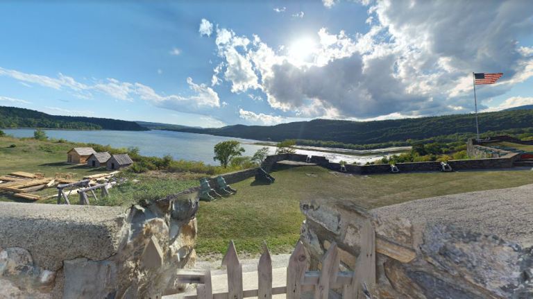 You can see here that the soldiers in the fort would have had a good view of the lake and would have been able to control traffic on the lake.
The fort was not used after the revolutionary war, and it fell into disrepair before being restored as a National Historic Monument. The cannon at the restored fort had originally been cast by the British for use in the Revolutionary War, but they were not sent over before the war ended.
I have been setting shorter distances between destinations for better motivation for my daily walking and so far it has been working. I have been walking more each day and have made good progress on my Virtual Hike. I am still a few stops behind on my posts.
Now that I am in New York I am heading south down through, or near, the Hudson River Valley. I have some interesting stops planned along the way.
Steven
Images in this post are from Google Maps and Street View.

Woahh
Pingback: Virtual Hike to Chestertown, NY | Braman's Wanderings