Today I found an 1870 map of land ownership for Henry County, Iowa on Ancestry.
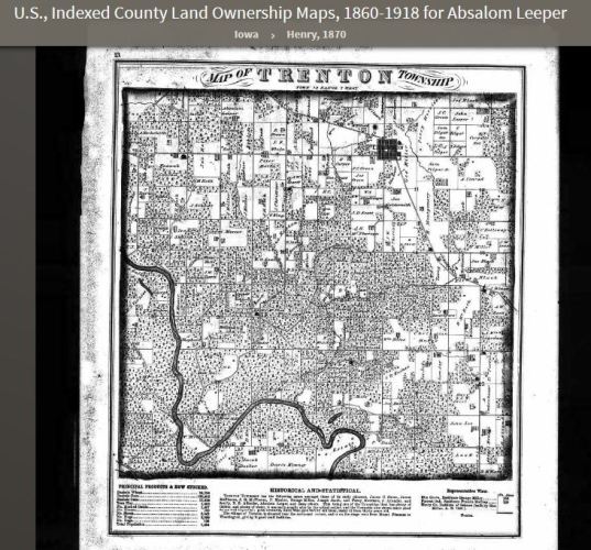 My 4th Great Grandfather Absalom Leeper lived there in 1870, so I was able to see exactly where his land was.
Absalom lived in Trenton Township near the town of Trenton.
 Here you can see where Trenton Township is in Iowa. It is just northwest of Mt. Pleasant which is the county seat of Henry County.
 On this map you can find two plots of land for the Leeper family.
 Here is the land for Absalom Leeper. He owned a quarter section. The north part of the land is uncleared and there is also a tree claim. You can also see that a creek runs through the north part of the land.
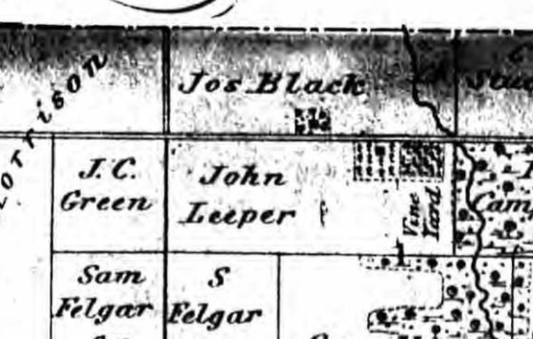 John Leeper, the brother of my 3rd Great Grandfather William Absalom Leeper, had a plot of land east of Trenton. You can see here that he had a vineyard on his land as well as a tree claim. Also the rest of his land was cleared.
John was a doctor, and I have an interesting story to tell about him someday.
 I decided to use Google Maps to look at a satellite view of Trenton Township and see if I could find the land on a modern map.
 Here are the two plots of land. Luckily some of the roads are still there and you can also see some of the section outlines based on changes in land use from one plot to the next.
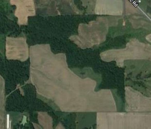 Here is the quarter section that belonged to Absalom Leeper. Can you see the outline of the land?
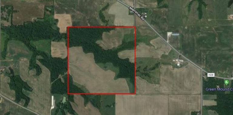 Here is the land outlined. In this view you can see the road that was in the 1870 map. You can also see a little green icon at the far right. It is for Green Mound Cemetery. I need to write a post someday about this cemetery as it is where Absalom is buried.
I also received an e-mail today about when the Leeper family was in Osnaburg, Ohio. I may have more information to share after a little more research.
You can find out a little bit more about how Absalom Leeper ended up in Henry County by visiting my post A Leeper Migration.
Steven

Pingback: Maps | Braman's Wanderings
Pingback: Leeper Farm Schedule | Braman's Wanderings
Pingback: Green Mound Cemetery | Braman's Wanderings