This week I reached a significant milestone on my Virtual Hike. I have now walked over 1K miles since the first of July. I will give a review of the legs of the hike so far. You can click on the links to see more about each segment, including views from Google Street View.
 The first leg of the hike was 131 miles to the Yosemite Valley Visitor Center. See: A Virtual Hike to Yosemite
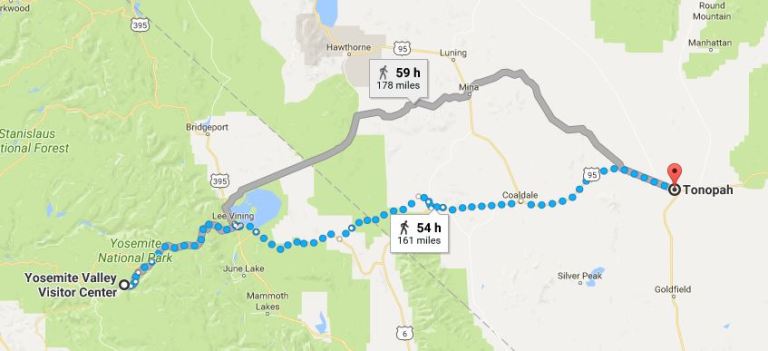 The next leg was 161 miles to Tonopah, Nevada. See: Virtual Hike to Tonopah
 Next up was Pioche, Nevada which was another 178 miles. See: Virtual Hike to Pioche
 Then it was on to Escalante, Utah which has been the longest leg at 189 miles. See: Virtual Hike to Escalante
 The next stop was then Bullfrog, Utah. This has been the shortest segment at only 98.4 miles. I had to end the hike at the Halls Crossing Ferry so that I could make Google maps work properly 🙂
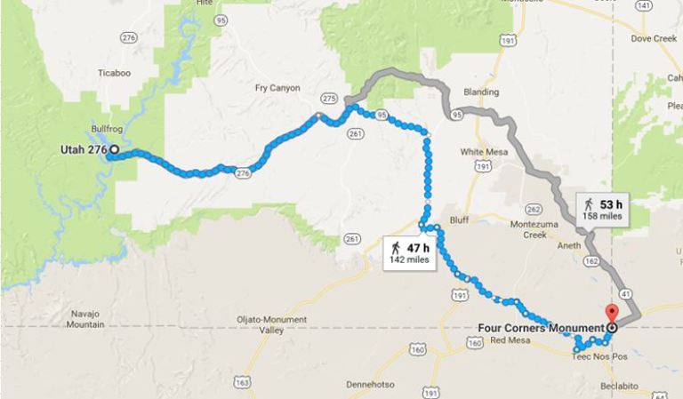 From Bullfrog I took a ferry across the river and continued on to the Four Corners Monument. This section was 142 miles. See: Virtual Hike to Four Corners
 My current leg of the hike will end at Chimney Rock, Colorado. This segment is 127 miles and I am less than 15 miles away after my walk tonight.
The next two legs of the hike will get me to the scout camp that I went to when I was in Boy Scouts. It is a bit too far for one leg, and I am finding that shorter legs make for better motivation 🙂
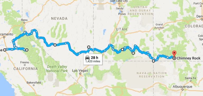 I decided to see how long the route would be if I went by car and stopped at the same way points. The result was 1,420 miles. However, the Yosemite to Tonopah segment could have been shorter, but Google would not take me through on Highway 120 in the winter time since it is closed.
The Virtual Hike has been good motivation for walking and I have lost more than 30 pounds since I started in July.
Now to see where the next 1,000 miles will take me.
Steven

Keep it up! Proud of you! ❤️