The next destination on my Virtual Hike was Minto, New Brunswick.
The previous destination on my virtual hike was Salisbury, New Brunswick.
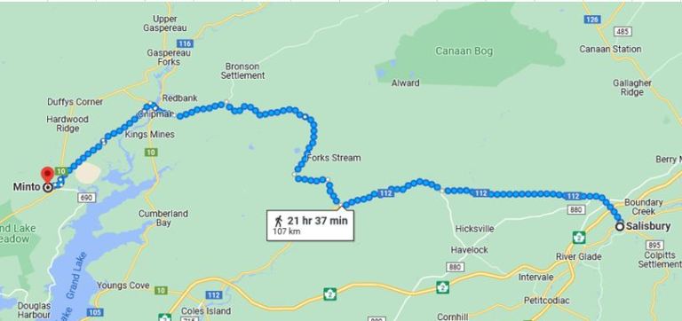 The virtual hike from Salisbury to Minto is mostly over flat terrain and through rural areas.
I am making my way across New Brunswick to the US Border.
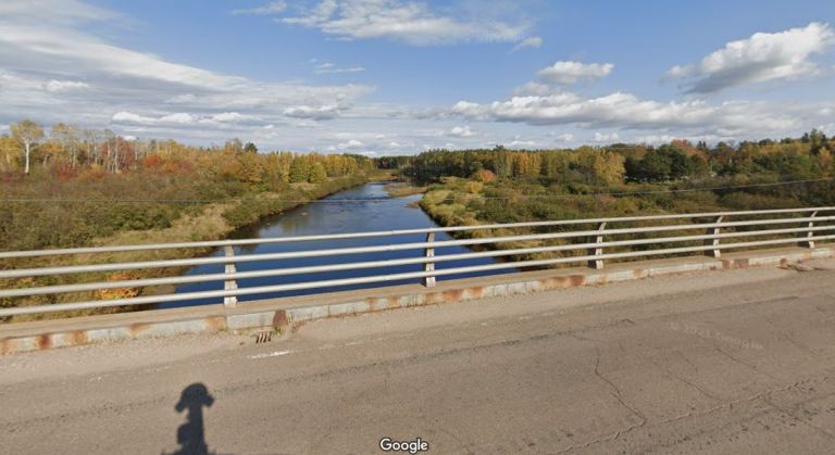 I crossed a few bridges during my virtual hike. You can also see the shadow of the camera of the Google car as it took images.
 Here is the second bridge. The bridge was very narrow and was only one way. Not a problem for a virtual hiker.
 I also hiked by a rural cemetery. If I was actually there, the genealogist in me would have had to stop and view the tombstones.
Some of the images were taken during autumn, so there were some colorful trees.
The route sometimes would go off road and follow trails where there were no images in Google Maps.
 Finally here is downtown Minto. You can see the post office with the name of the town on the sign and the Canadian flag.
There was no specific reason to choose Minto as a destination, but it was along the route back to the US. I am setting shorter distances between destinations for better motivation for my daily walking.
My current plan is to make my way toward northern New York through Maine, New Hampshire and Vermont. Perhaps I will find some interesting stops along the way. I already have an interesting stop planned for just over the border.
Steven
Images in this post are from Google Maps and Street View.

Pingback: Virtual Hike to Cross Creek Station, New Brunswick | Braman's Wanderings