Tonight I have been working on my presentation for class tomorrow. I guess if my students see this before the class they will get a preview. Or, they can look at the pictures a bit closer after the class.
 We will be covering I Samuel 16 and 17 so I decided to have some fun with maps to show the geography of the Elah Valley where David fought Goliath.
This map shows the general layout of the valley and where the armies would have been.
 Some of the questions that I always get in the class are how wide, how big, how far, etc..
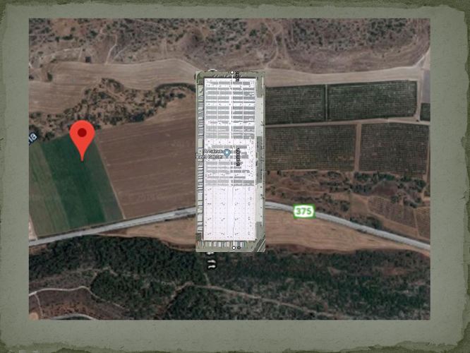
I decided to come up with an illustration of how wide the Elah Valley is. Everyone in my class knows how big the local Amazon distribution center is. I found that it will just barely fit between the walls of the valley. It will be a good illustration.
The valley is about 2,000 feet wide in most places.
 Another question will be how far is Gath from the Elah Valley. I used Google Maps to illustrate a possible path through the valleys following the Elah Brook. It would be a journey of about eight miles.
 David had a little longer journey from Bethlehem to go take supplies to his brothers.
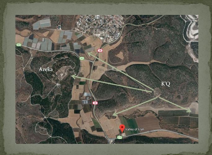 I also showed the views that the men would have from the two gates of Khirbet Qeiyafa. In my presentation I also have pictures that I took from the gates when I visited there.
Now a little more study and then take advantage of that extra hour of sleep.
Perhaps I will have some extra students in my class tomorrow if they forget to set back their clocks.
Steven
